Projects

Turquoise Canyon

Overview

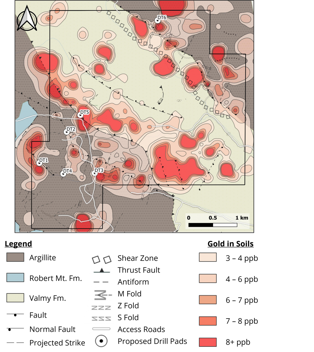
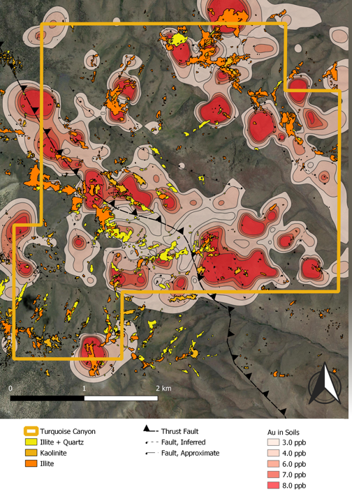
Turquoise Canyon Project is a greenfield property with moderate-stage exploration including soil and rock chip sampling, IP and gravity surveys, and airborne hyperspectral, demonstrating geological characteristics trending eastward from the Toiyabe Project.

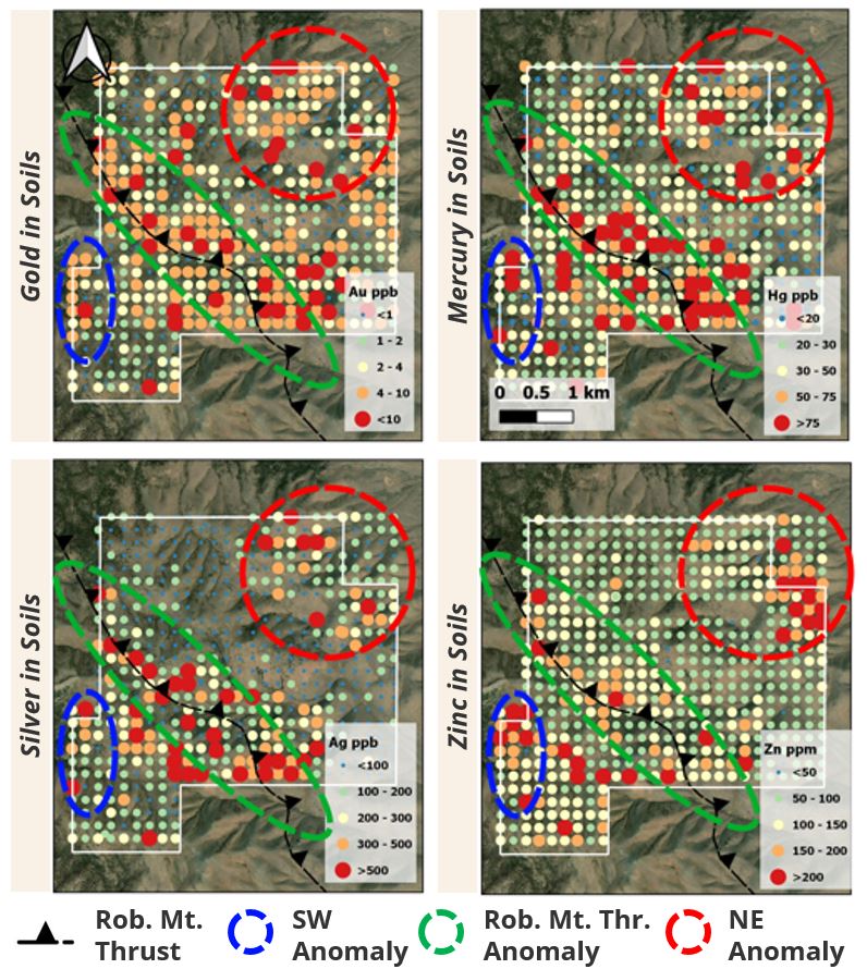
Turquoise Canyon shares its western boundary with the Toiyabe Project, and shares many of its structural features. 

The property consists of approximately 1,500 hectares of public land, administered by the Bureau of Land Management with 188 unpatented mining claims covering the property.

Surface geochemical anomalies, favourable stratigraphy, and observable structures are continuous from Toiyabe’s historical resource onto the Turquoise Canyon Project.

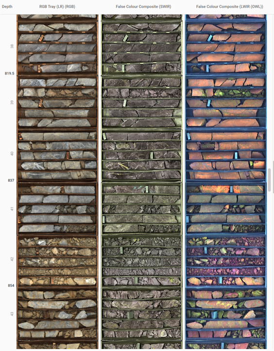
Turquoise Canyon has yet to see any drilling, demonstrating blue-sky potential 

Target Zones

  • Anomalous gold in soils associated with the Roberts Mountains Thrust 
  • Soil anomalies are continuous from the Toiyabe Courtney Zone immediately to the west
  • East-west structures in the historical Toiyabe resource extend to Turquoise Canyon
  • Structures and geochemical anomalies are completely untested with drilling

AIRBORNE HYPERSPECTRAL SURVEY

  • High ground resolution infrared imaging across multiple wavelength ranges to capture a broad array of mineralogy (completed fall of 2021)
  • 35 km2 total aerial coverage (focused on TC but also including Toiyabe historical resource, Toiyabe Saddle Mine, and northern areas of East Saddle)
  • Clays commonly associated with Carlin deposits present at:
    • Courtney historical resource
    •  Toiyabe-Saddle open pits
    • Turquoise Canyon 
  • Clays occur along northwest trend of mineralization and mapped thrust
  • Alterationion patterns observed at adjacent areas of mineralization are present at Turquoise Canyon


INDUCED POLARIZATION (IP) SURVEY

  • Induced Polarization measures chargeability and resistivity of subsurface materia
  • 17 line-kilometer survey (over 6 lines), primarily covering Turquoise Canyon completed in the fall of 2021
    • One line extended directly over historical resource at Toiyabe, in order to match its signature to those seen within Turquoise Canyon survey area and improve drill targeting
  • Historical Courtney resource host rock (Wenban – “Dw”) shown to exist at Turquoise Canyon based on resistivity values
  • Depth to Lower Plate Wenban estimated to be 150-250m at Turquoise Canyon
  • Series of Horst and Graben blocks associated with alteration features indicate widespread extension of favourable host rocks onto Turquoise Canyon

Technical Report

Turquoise Canyon NI 43-101